


Voting District 210002, Chenango County, New York
About
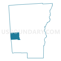
Outline

Summary
| Unique Area Identifier | 626005 |
| Name | Voting District 210002 |
| County | Chenango County |
| State | New York |
| Area (square miles) | 28.15 |
| Land Area (square miles) | 27.67 |
| Water Area (square miles) | 0.47 |
| % of Land Area | 98.32 |
| % of Water Area | 1.68 |
| Latitude of the Internal Point | 42.42596050 |
| Longtitude of the Internal Point | -75.81081330 |
Maps


Graphs
Select a template below for downloading or customizing gragh for Voting District 210002, Chenango County, New York


Neighbors
Neighoring Voting District (by Name) Neighboring Voting District on the Map
- Voting District 050001, Chenango County, NY
- Voting District 060001, Chenango County, NY
- Voting District 090001, Chenango County, NY
- Voting District 140003, Broome County, NY
- Voting District 160001, Cortland County, NY
- Voting District 210001, Chenango County, NY
Top 10 Neighboring County Subdivision (by Population) Neighboring County Subdivision on the Map
- Greene town, Chenango County, NY (5,604)
- Triangle town, Broome County, NY (2,946)
- Smithville town, Chenango County, NY (1,330)
- Willet town, Cortland County, NY (1,043)
- McDonough town, Chenango County, NY (886)
- German town, Chenango County, NY (370)
Top 10 Neighboring Place (by Population) Neighboring Place on the Map
Top 10 Neighboring Unified School District (by Population) Neighboring Unified School District on the Map
- Whitney Point Central School District, NY (9,080)
- Greene Central School District, NY (6,971)
- Oxford Academy and Central School District, NY (5,359)
- Cincinnatus Central School District, NY (3,821)
Top 10 Neighboring State Legislative District Lower Chamber (by Population) Neighboring State Legislative District Lower Chamber on the Map
Top 10 Neighboring State Legislative District Upper Chamber (by Population) Neighboring State Legislative District Upper Chamber on the Map
Top 10 Neighboring 111th Congressional District (by Population) Neighboring 111th Congressional District on the Map
Top 10 Neighboring Census Tract (by Population) Neighboring Census Tract on the Map
- Census Tract 9711, Cortland County, NY (4,823)
- Census Tract 9708.02, Chenango County, NY (3,721)
- Census Tract 119.01, Broome County, NY (2,946)
- Census Tract 9707, Chenango County, NY (2,397)